Underground Portal
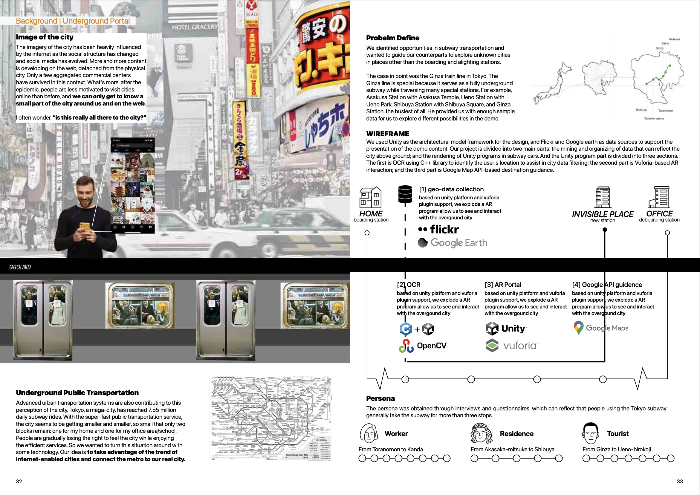
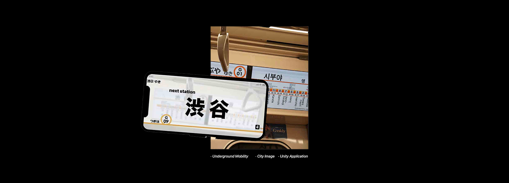
Advanced urban transportation systems are also contributing to this perception of the city. With the super- fast public transportation service, the city seems to be getting smaller and smaller, so small that only two blocks remain: one for my home and one for my office area/school. People are gradually losing the right to feel the city while enjoying the efficient services. So we wanted to turn this situation around with some technology. Our idea is to take advantage of the trend of internet-enabled cities and connect the metro to our real city.
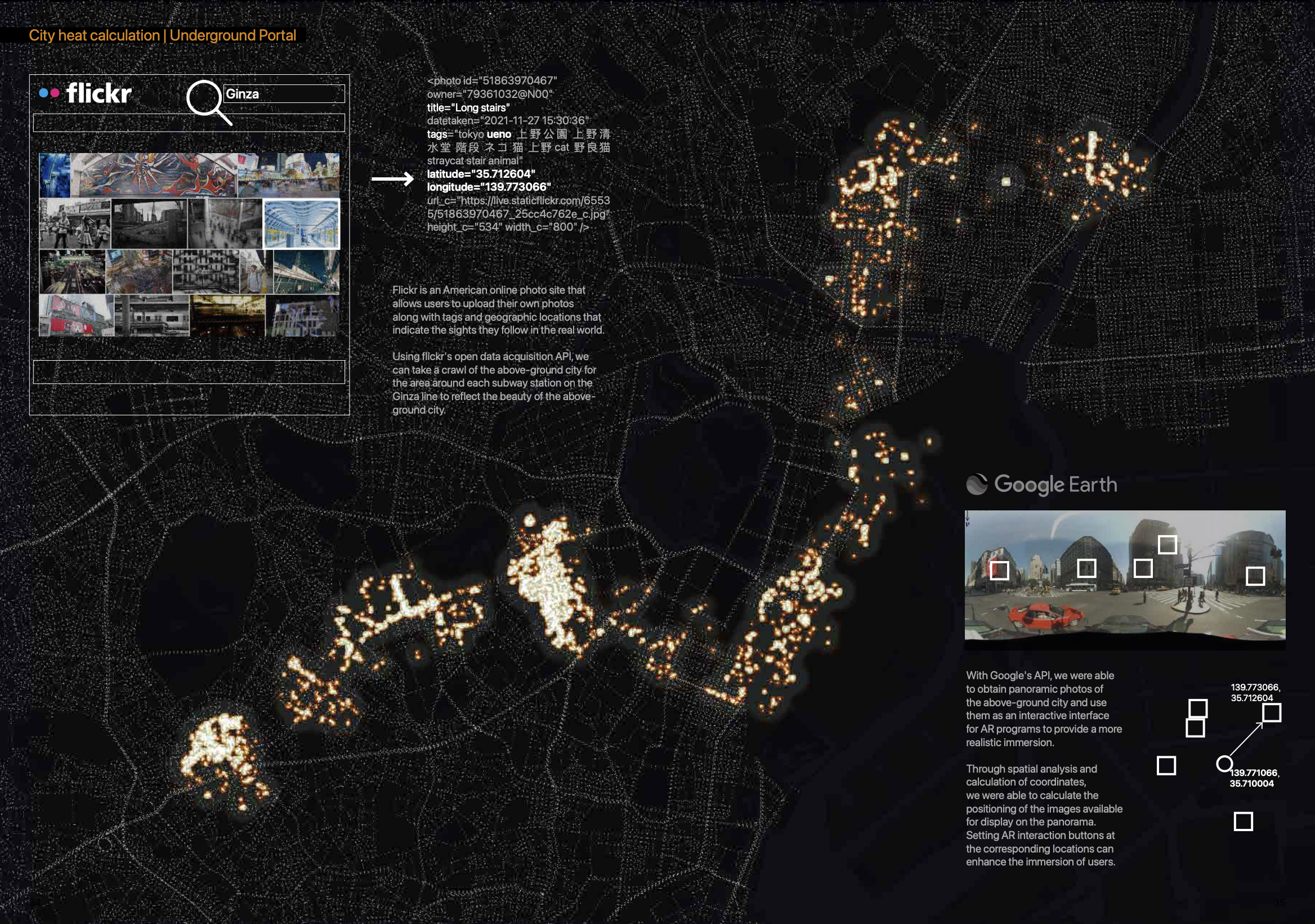
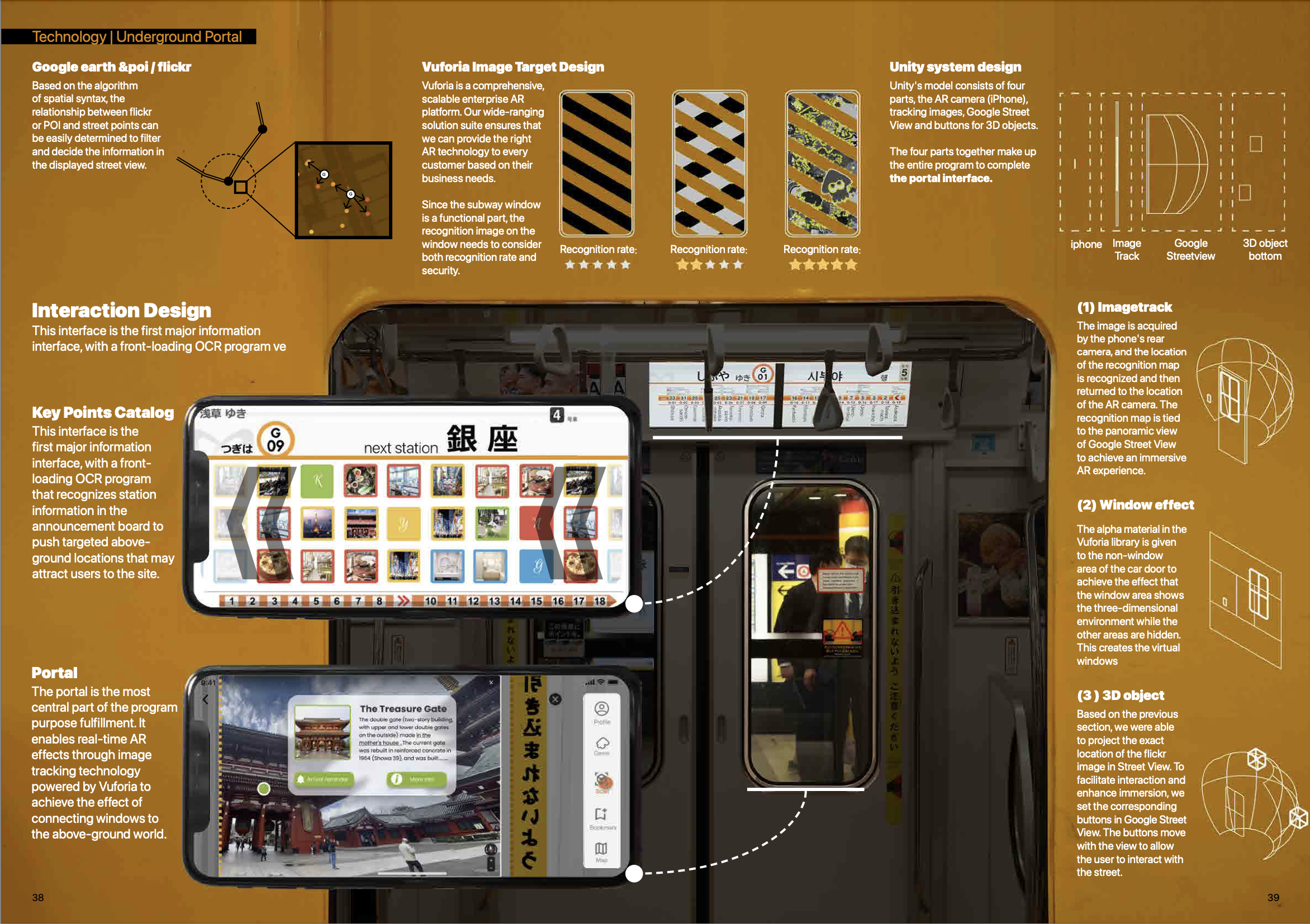
We used Unity as the architectural model framework for the design, and Flickr and Google earth as data sources to support the presentation of the demo content. The actual demo is covered in three sections. The first is OCR using C++ library to identify the user’s location to assist in city data filtering; the second part is Vuforia-based AR interaction; and the third part is Google Map API-based destination guidance.